| |
Land near the Shenandoah River, Blue Ridge Mountains, and Massanutten Mountains
|
|
Home/Contact Info
Lot List
Area Photos
Plat
Local Attractions
Request More Info
|
| |
Cavalier Farms, Rileyville, Virginia
Maps & Directions
|
|
| |
|
Use File | Print to print map & directions.
|
|
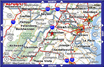
Directions from Washington, D.C.: Take I-66 West. Get off at Exit No. 6, Front Royal.
Go south on Route 340 for about 20 miles. You'll go through the towns of Bentonville,
Limeton, Overall, and then Rileyville. You'll go by two railroad overpasses. The
nearest "landmark" is a neighborhood store called "Kelley's Point." Look for a sign
for VA Route 661. Turn right on Cavalier Road (Route 661). 422 Cavalier Road is at the top
of the hill across from a pond. If you reach Luray, about 5 miles south, you've gone too far.
Get door-to-door directions at mapquest.com
|
| |
| |
© 2013 - 2020 Cavalier Farms
Web design by Software Tailors, Inc.
Last updated 03/20/2017.
|